
April 23rd, 2025 Southwest Kansas Tornado Warned Supercells
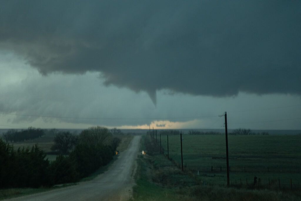
April 23rd took me to southwest Kansas. A surface low and triple point was southeast of Goodland. Models showed supercells developing on the dryline and interacting with the warm front as they moved northeast and were forecast to spin hard there. That’s exactly what happened. I intercepted one supercell near Healy, Kansas that attached itself to the warm front in an environment of high theta-e air and it became tornado warned. I had to drive through copious amounts of golfball sized hail to get to the hook and what a beauty it was!! Low bowl shaped wall cloud with rain/hail wrapping around it as it spun HARD. It tried to cone up a couple times but couldn’t maintain it’s tight rotation to get a tornado down. Eventually it moved into colder air north of the warm front and weakened. I dropped south to catch another developing supercell west of Kalvesta, Kansas. a massive bowl shaped lowering was spinning hard. It produced a tapered funnel halfway to the ground, but never did contact it. Structure was nice with that classic backward “C” shape to the RFD eroded updraft. It also crossed into colder air and weakened. By then it was almost dark and time to head to the hotel for the night. Fun day and enjoy the pics!

No comments yet.