
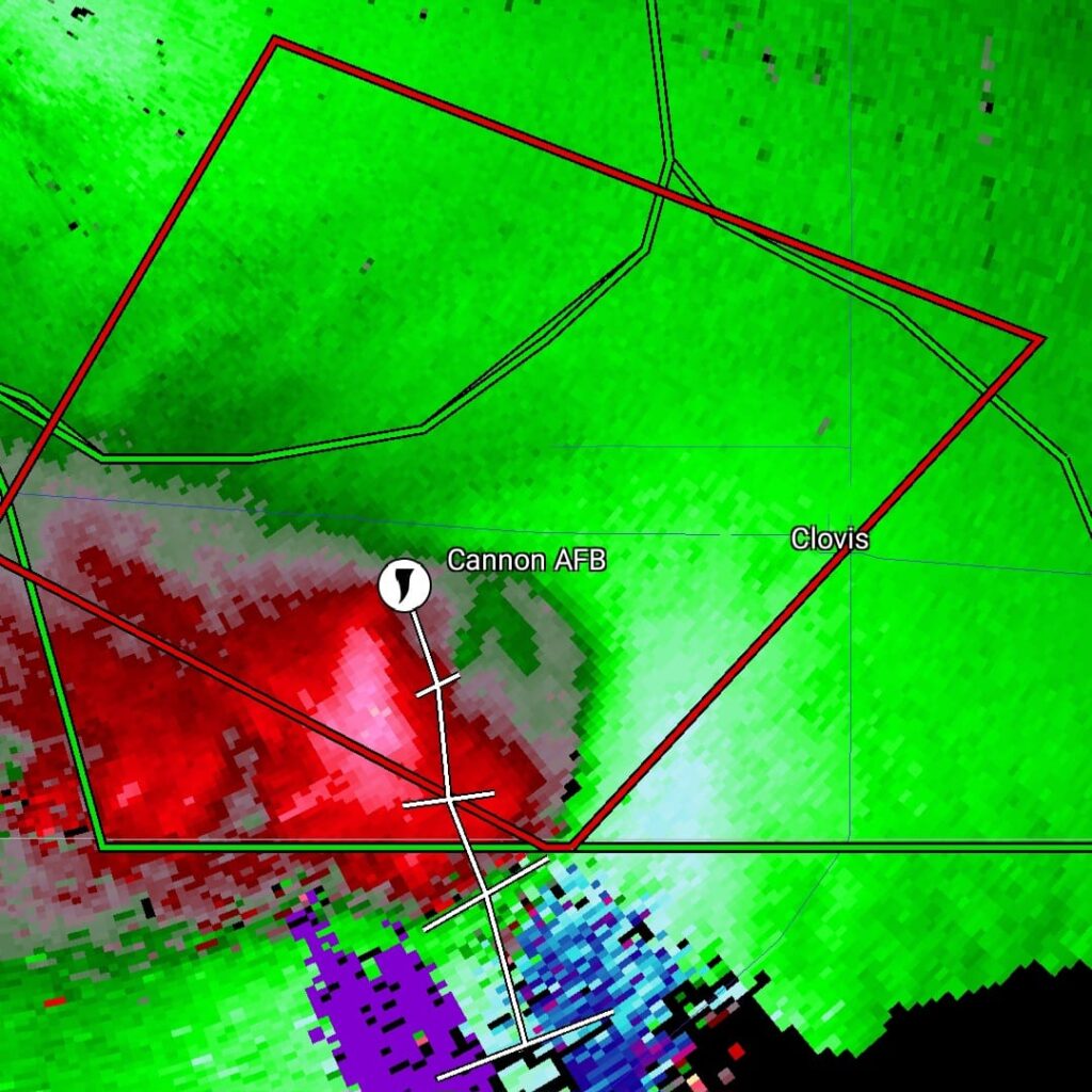
May 29th Clovis New Mexico Tornadic Supercell
May 29th was a marginal day at best. Southeast Colorado looked like the place to be. However, with moisture pooling along a boundary in east central New Mexico, I had a hunch that would produce decent supercells late in the day and evening. The Colorado target got interesting and produced a couple tornado warned storms ( See the previous chase account for the Prime Time Minitour!!!), but I chose to wait and see what would happen in New Mexico. I was not disappointed!!!! By early evening as a short wave trough approached, storms developed northwest of Clovis. It didn’t take long to see they were anchored and would start spinning quickly. As we approached the northeast side of Clovis, a tornado warning was issued. Numerous images from various locals and also my defunked video camera showed what appeared to be a cone tornado northwest of town. The NWS in ABQ is currently validating the tornado based on images, video and local chasers in the area. We nearly had the storm to ourselves, which is quite rare in this day and age!!!! We dropped through Clovis and ended up north of Portales, NM and sat and watched the storm spin like crazy. It was constantly tornado warned. The structure was absolutely top notch, even in the dark and hook after hook formed on this anchored supercell! Finally, by late evening, things started winding down, so we drove to Amarillo to our hotel for the night. One of the BEST structured supercells of 2024, even in the dark! Please enjoy the pics and NO they are not photoshopped!!!!

No comments yet.