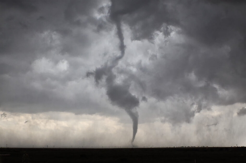
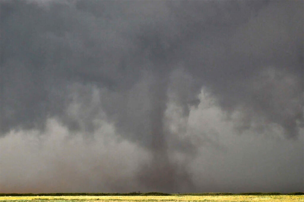
June 5th. What more can be said??? One of the most incredible days in the 2025 storm chasing season! We started off the day in Lubbock, Texas. The target was to find the triple point, which appeared based on satellite and surface obs to be near Dora, New Mexico. We positioned ourselves near Causey, NM where 2 large updrafts were forming. We decided to play the southern most developing storm. The storm sat anchored for a couple of hours before it finally started its trek southeast along an outflow boundary from previous days storms. Just before it reached the Texas border it spun hard and became tornado warned. The merry go round ensued and quickly dropped a tapered cone tornado that was on the ground for a couple of minutes. It lifted as the storm moved east, but the low level mesocyclone stayed in tack. Soon several different tornadoes formed, and eventually stout stovepipe tornado descended. After this another elephant trunk shaped tornado formed as well. You could see the occlusion happened with the old meso dying and a new one forming east of us. We blasted east to get on the other side of it and quickly an extremely large, very dusty tornado formed. It grew to a mile wide and just missed the town of Morton, Texas. We got ahead of the tornado as it became completely obscured with dust and rain. Several miles east of town it disippated, and yet another tornado formed just to our north. Within a few minutes very strong RFD winds and atomized rain smacked into us, so we blasted east to try to get ahead of it. As we did, another ghostly white tornado came out of the rain just to our north. Realizing the mesocyclone was hopelessly buried in dirt and rain, we blasted east towards Lubbock. Another very large tornado occurred right to our north that we could not see, so we decided it was time to call off the chase. Later that evening, after we ended the chase, one last tornado formed near Reece Center. Since we were already done and settled into our hotel, we did not go back out because it would have been too late to make it there. An absolutely CRAZY day and I am so thankful there were no fatalities with this supercell. Enjoy the photos and this Youtube video of the Morton tornado. Another video will be made soon showing the rest of the tornadoes!
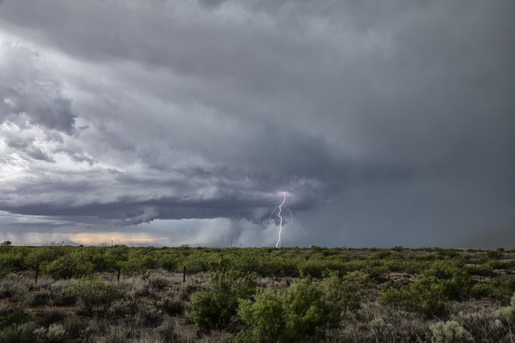
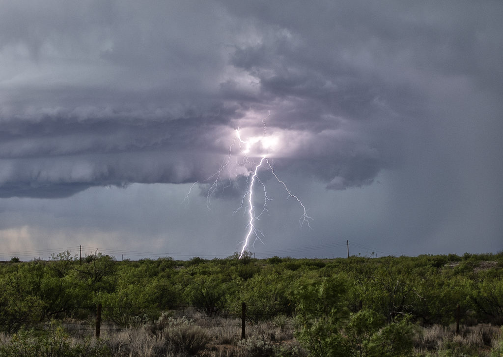
June 2nd Jal, New Mexico Supercell
We weren’t expecting a great show this date as the ingredients just weren’t there. Marginal moisture and weak wind shear would limit the longevity and structure to storms this day, but we did manage to capture a couple of pretty supercells. We started the day in Lubbock, Texas so it wasn’t far to get into position. An old outflow boundary would provide to focus for storms. Due to the steep lapse rates and rapid cooling of the hot boundary layer as air rose aloft, storms became hailers and also were nicely electrified! The cells shown below produced hail the size of golfballs and 80 mph outflow winds, which generated a lot of blowing dirt across west Texas. It was getting late in the season to chase this far south, but you go where you need to. Many days of excessive heat dried up the landscapes which fueled the fire so to speak with intense blowing dirt. Fun day regardless! Enjoy the pics below!
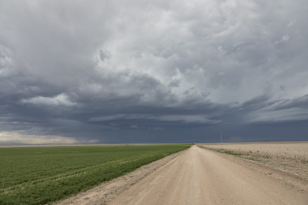
May 2nd Northwest Kansas Severe Thunderstorms
Day 1 of Tour 2 took us north from Oklahoma City to western Kansas. Shear was good this day, however moisture was lacking. This resulted in higher based severe thunderstorms with hail and high winds. Some of the areas of northwest Kansas near the Smoky Hill River bottoms are full of badlands type formations and make for a great photo! Lots of lightning also occurred with these storms as the built southward along an advancing cold front. Fun first day for Tour 2!! Enjoy the pics!
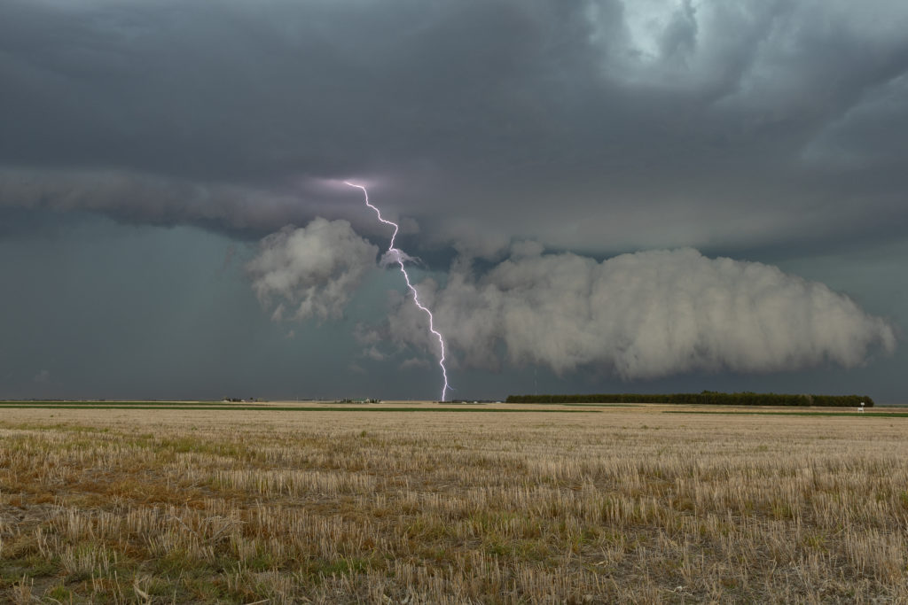
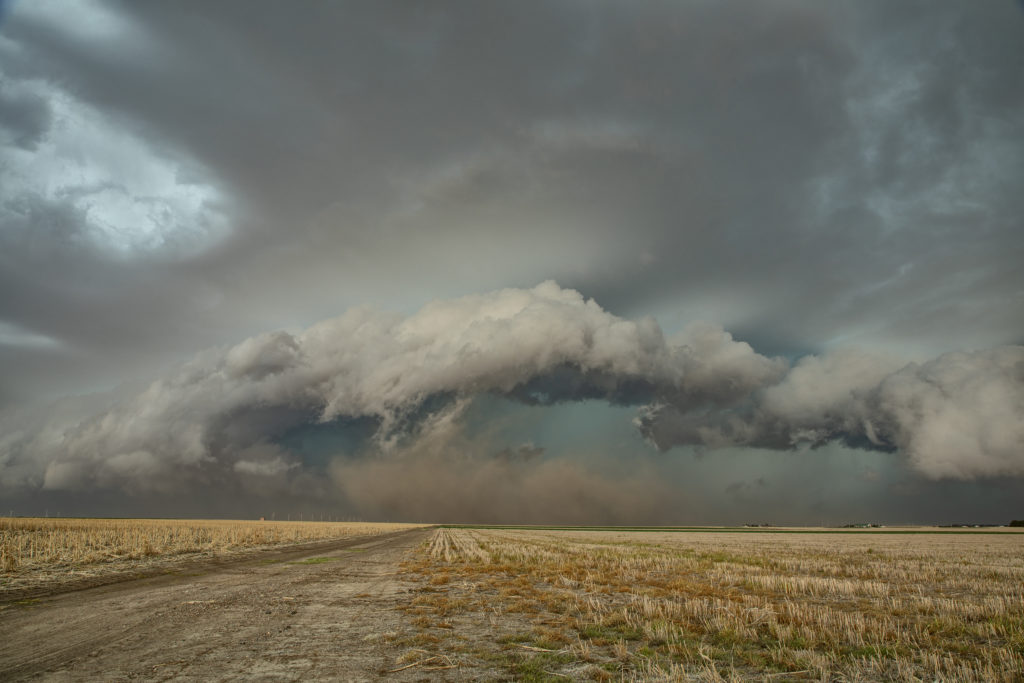
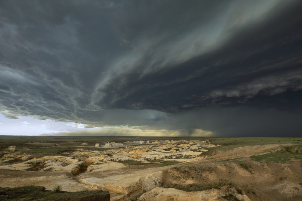
April 21st Western Kansas Supercell
April 21st didn’t look great on paper. However, storms erupted along a lee trough in far western Kansas and intensified as they moved eastward. A couple of embedded supercells would produce 70 mph winds and golfball sized hail. With the pretty Smoky Hill River badlands in the foreground, it sure made for a pretty scene! Bases of the supercells were quite high, as much as 8000 feet off the ground. Structure was pretty and lightning became frequent. We stayed with the storms until they weakend mid evening and then headed south for the night. I nice surprise chase for us on a day when it didn’t look very good at all!