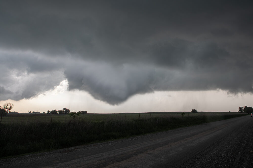
May 13th showed significant moisture and instability along a warm front and outflow boundary from previous days’ convection. The boundaries met and formed a triple point southwest of Des Moines, Iowa. Storms fired very early by 1pm and became tornado warned. Nothing significant formed but we stayed with them. Several false reports of multivortex tornadoes occurred, which has been the case all spring. The old philosophy of if you aren’t sure it’s a tornado, it is not one should be taken by many storm chasers! Numerous tornado warnings were issued, and the monster supercell spun like crazy. It eventually weakened as it moved east off the boundary. Another supercell formed southwest of Pleasantville and produce at least 3 tornadoes that we witnessed. A multivortex, an elephant trunk and then another multivortex that was less than a quarter mile from us! The motion was incredible right over the vans as this tornadic storm drifted northeast and produced. An overall exciting day that the guests loved! Enjoy the pics!!!!
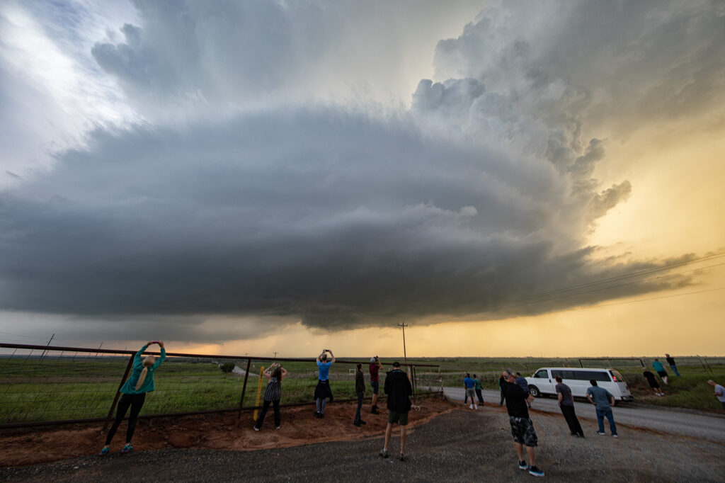
May 11th Central Oklahoma Tornado Warned Supercells
Great potential on May 11th!! Good moisture and instability would occur, as well as lift along a dryline, would result in several tornado warned supercells and one that produced a couple of night time tornadoes near Noble, OK. We chased south of the OKC area early as a supercell formed. It eventually died off as it ingested dry air. However, north of that several storms went up and spun, becoming tornado warned. One storm took us towards Lindsay, OK and attempted to drop a tornado. The funnel came halfway down and receded. Structure was very pretty as the supercells became very well organized. In a weird ending, one of the first storms we chased dropped the tornadoes. This storm was in the middle of a line of supercells, which typically is unusual. Almost always chase the tail end storm that has no competition for air, but this was not the case today! Enjoy the pics!
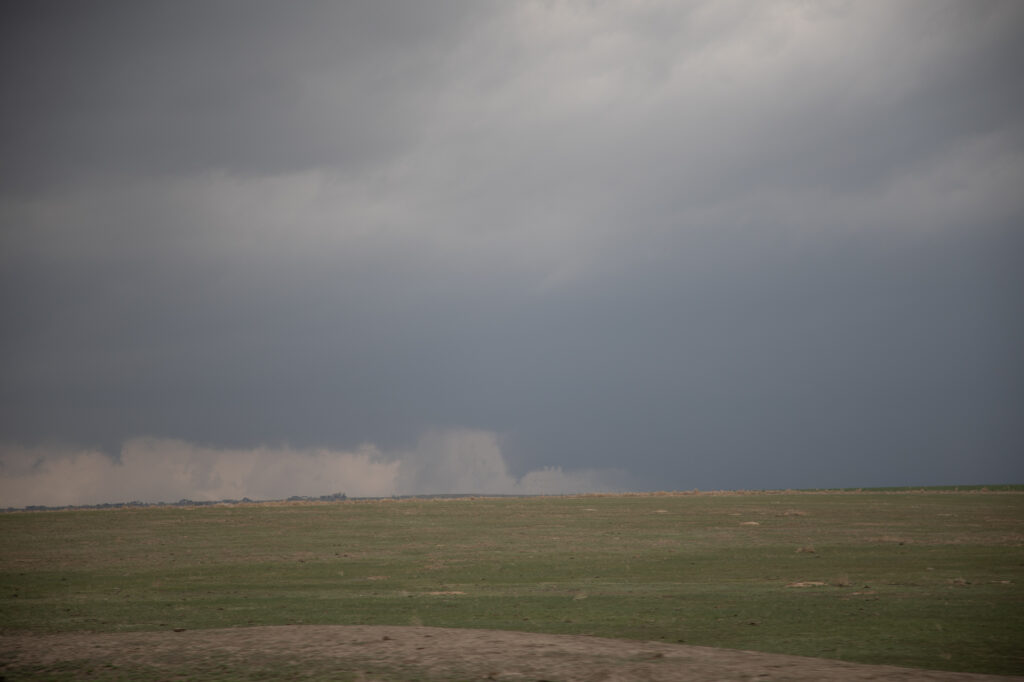
May 10th Akron, CO Tornado and Supercell
May 10th had great potential in eastern Colorado. Upslope flow, and approaching short wave, good moisture and moderate instability would set the stage for intense storm formation by early afternoon. Initial storms would cluster and produce copious amounts of hail around the Denver metro area and just east. A boundary draped along I-76 eastward towards Wray would be the focus for a few supercells that would produce a couple tornadoes. We were heading towards Akron when we encountered a HUGE line of chasers stopped at construction red lights. This delayed us almost 30 minutes! We ended up watching a tornado from the construction back up and had no way to get east due to flooded and extremely muddied dirt roads. A frustrating day, but at least we managed to catch a tornado!
May 9th Central Kansas Supercells
Surging outflow would be the big deal this day. Storms would form on the cold side of a boundary and have very little tornado threat. However their structure was quite pretty. Elevated supercells would produce hail up to softball size and torrential rain. We chased one storm from near Larned, Kansas east towards Hutchinson. A couple other elevated supercells also formed just to the southwest and became hailers as well. With the elevated nature of the storms, the tornado potential was near zero. Hopefully the huge hail didn’t cause too much damage to the farmlands and ranchers in the area!
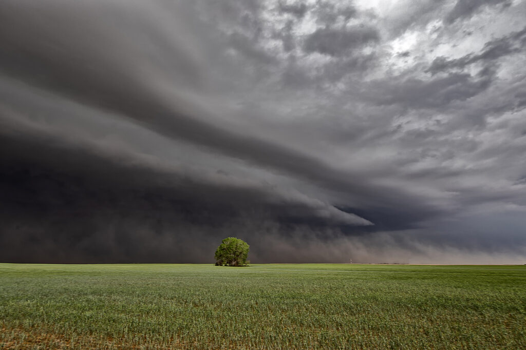
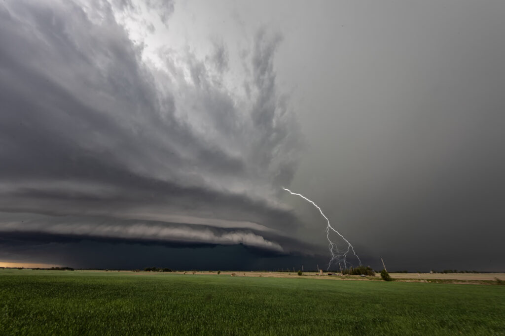
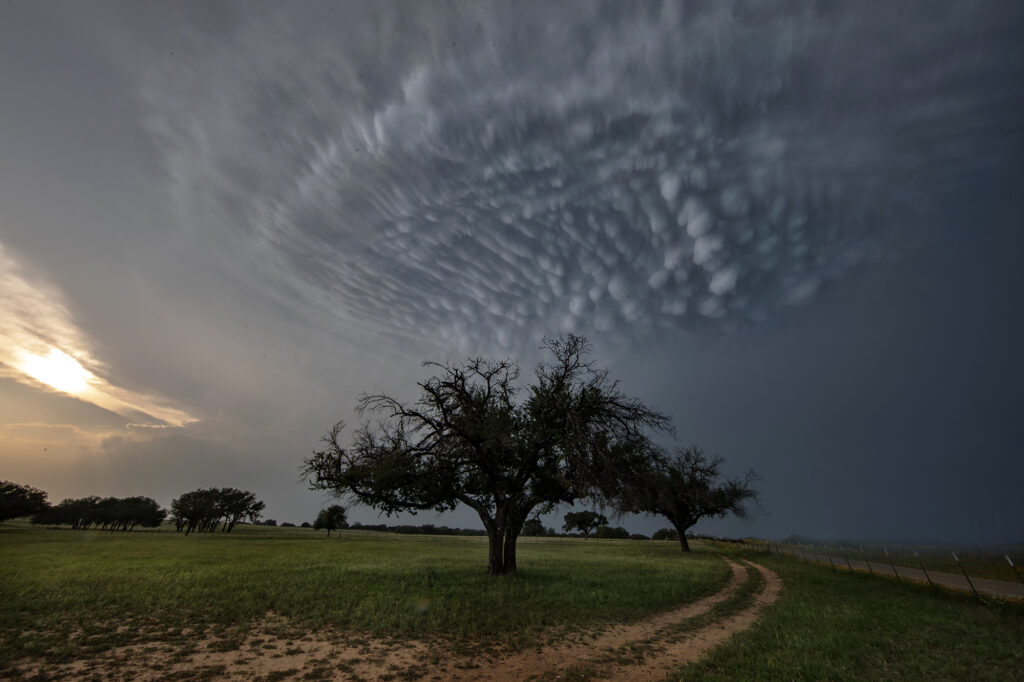
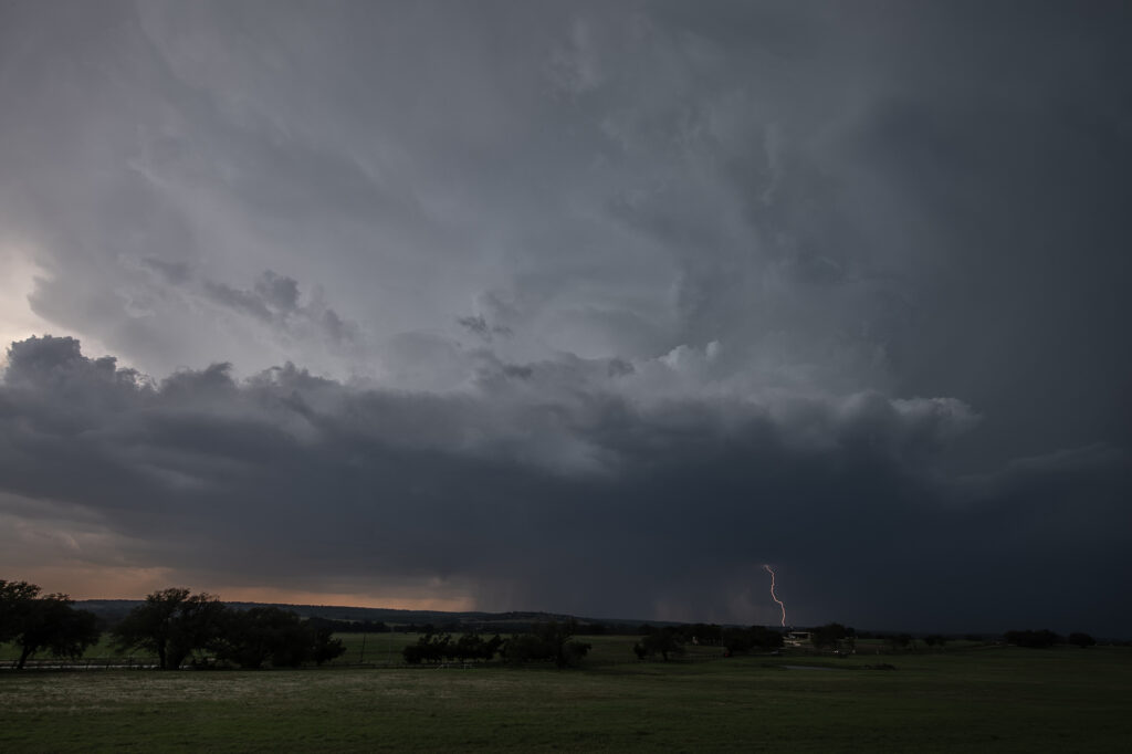
May 5th Central Texas Intense Supercell
May 5th brought deep moisture into central Texas, along with moderate instability and decent wind shear. Storms formed west of Hamilton and moved southeast. One storm right turned as it started spinning and moved all the way to the north side of Austin before weakening. It had good structure, monster sized hail and was very electrified. It produced stunning mammatus clouds as well. The rotation buried well back in the core was very strong, and it may have produced a tornado that would have been not visible due to the heavy precipitation. Nonetheless, it was a treat to watch and enjoy!
April 14th Medicine Lodge, Kansas Severe Thunderstorm
April 14th had plenty of shear, decent instability and a dryline in place. However, moisture was lacking, but enough of present to fire severe storms along the dryline late afternoon into the evening. I took the group the furthest south we could to get closer to better moisture, but still have enough forcing to help maintain storms as they moved off the dryline. Several storms formed and most went severe warned. However the tail end storm, as is often the case, became the strongest. Near sunset it started producing numerous lightning strikes, some starting fires. The structure was pretty good with the shear in place and it gave us a nice show as it rolled east towards Wichita. A fun day, we got about what we thought we would and had some very pretty scenes in the gypsum hills south of Pratt. Enjoy the pics!
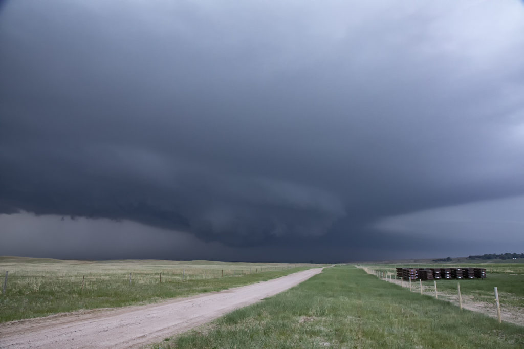
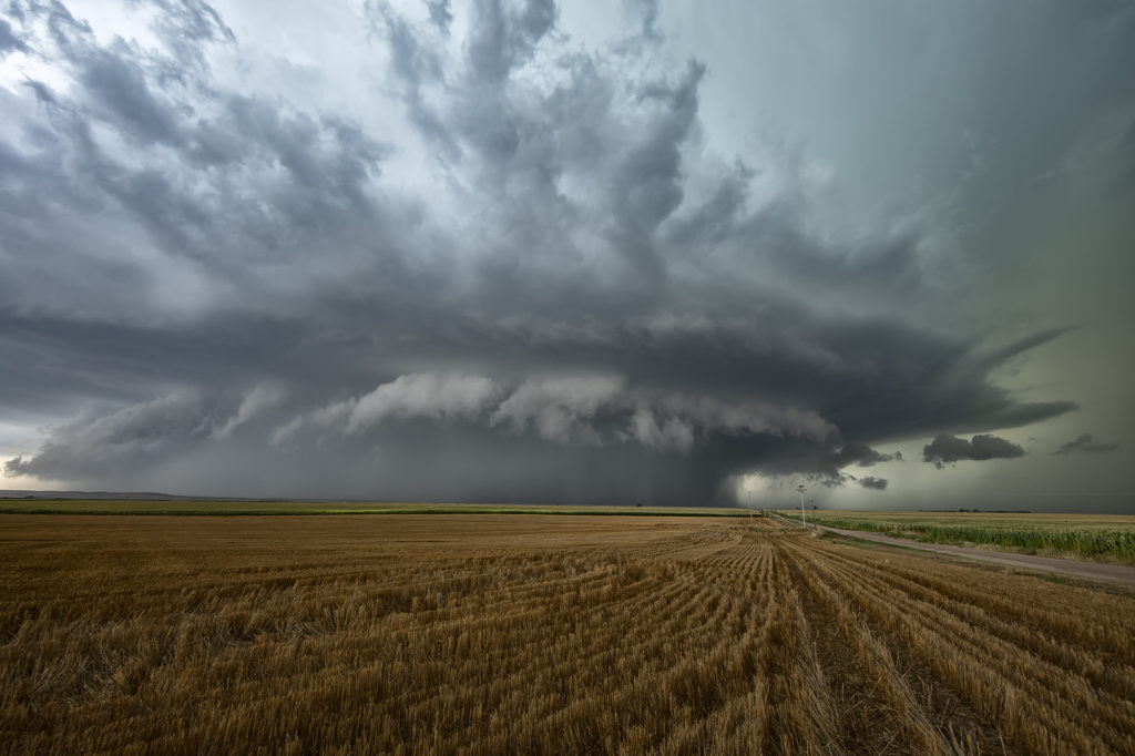
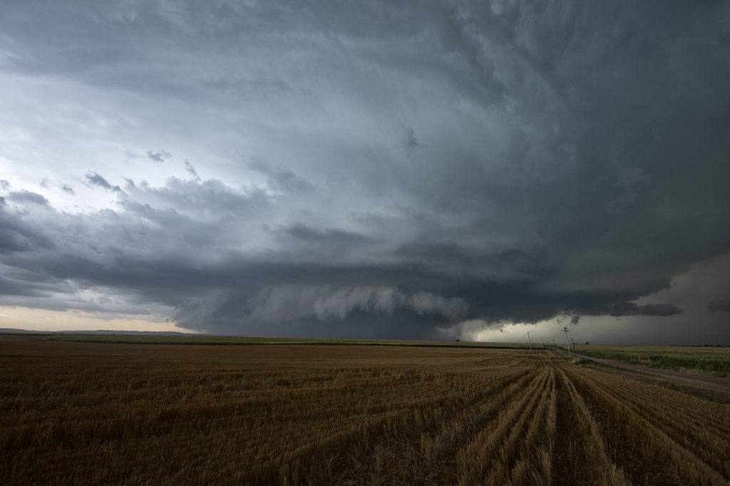
May 29th Central Nebraska Tornado Warned Supercell
May 29th was the classic “day before the big day” type set up. Moisture and instability were rapidly increasing along a lifting warm front in Nebraska, and shear was quite strong. Models showed late afternoon and early evening supercells forming north of Broken Bow and that is exactly what occurred. It took awhile from the main supercell to root along the boundary and get organized, but once it did, it became a formidable storm! Eventually it became tornado warned as it moved to the northeast and stayed warned for a few hours. Due to storm motion and poor roads, it became virtually impossible to stay with it. Near O’Neill we had to let it go and head to Sioux Falls, SD for the night. The storm had good structure, and it had a well defined rotating wall cloud. It just couldn’t tighten enough to get a tornado to form. Enjoy the pics!
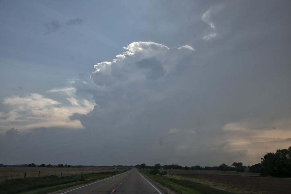
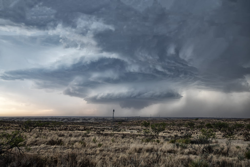
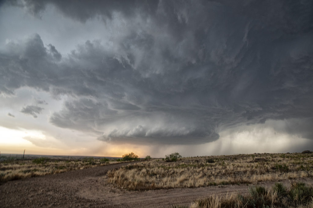
May 1st Texas Panhandle Supercell
May 1st had some potential in the Texas panhandle west of Amarillo. Moderate quality moisture was streaming north as a cold front drifted southeast. Great shear was also present. A cluster of storms developed west of Lubbock and raced northeast spewing outflow. I was certain it would ruin the rest of the day, however a supercell survived the blowing dirt and cold air from the now decaying storm cluster west of Channing. The cell slowly moved east and started getting a great classic supercell appearance. As the sun set, it just added to the beauty of the storm. We ended up losing it in the hills northwest of Amarilla due to a poor road network and other storms forming. But in the end it treated us to a nice show that we weren’t expecting. Enjoy the pics.
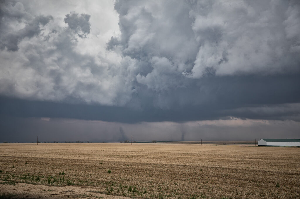
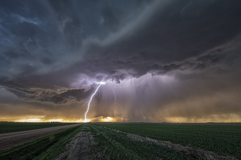
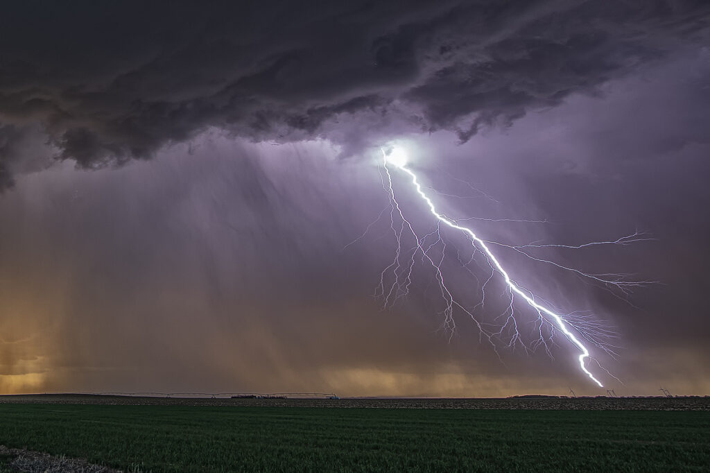
August 19th Lamar, NE area Tornadic Supercell
August 19th looked too good not to chase. Good moisture, high CAPE values, strong lift with an approaching wave and good low level shear along a boundary would set the stage for a good day! Mid afternoon storms exploded over northeast Colorado and slowly intensified. One particular storm, south of Holyoke, CO became a supercell. As it drifted east/northeast along the boundary it took off and became tornado warned. Very very strong low level rotation was occurring and the low level mesocyclone eventually became rain wrapped where you couldn’t see it anymore. Extremely heavy rains (4-9 inches!) prevented me from taking dirt, now mud, roads to get into the notch for a better look. However, the storm did produce a tornado, possibly two, one of which was a fast funnel in the hook area before it wrapped up in rain. A fun chase day, and good results, just wished for a better view in the notch! Enjoy the pics!
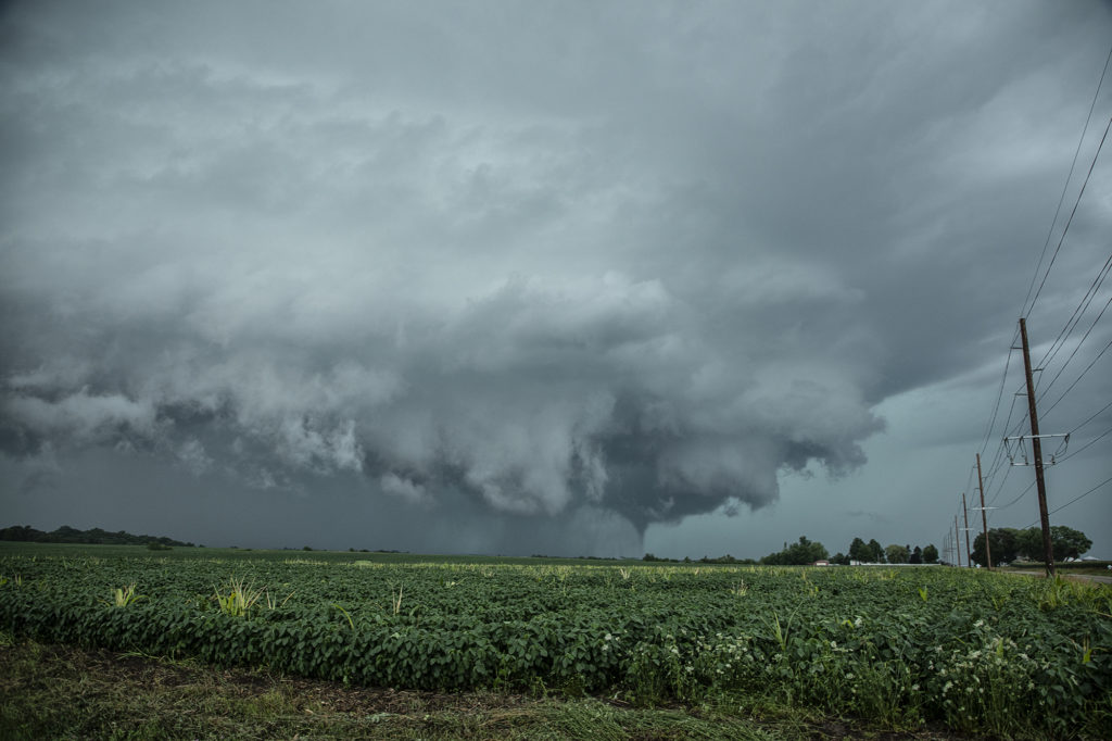
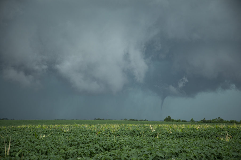
July 14th Central Iowa Tornadoes
July 14th had it all. Boundary, great moisture, instability and good low level shear. We blasted from Pierre, SD to central Iowa as storms formed and became severe and tornado warned. Several tornadoes did occur in central and eastern Iowa with one particular tornado we just missed by 15 minutes being the most intense near Lake City. Frustrating day to say the least, but we still managed some great supercells and a tornado late in the day. Moral of the story is to NEVER give up until storms are weakening and loss of heating reduce instability.